
August 10
Miles hiked: 3
Total trip mileage: 373
I am putting in three miles for today, even though it’s officially a “zero” day, because getting around Lake City involves quite a bit of walking. We stop by the Raven’s Rest hostel and drop off un-needed food from our resupply box. (BTW, the undies made it, thanks Rick!) Marc introduces me to his newest friends, a couple from Alabama who run the outfitter shop; they arrange a shuttle back up to the pass for us. The free shuttle doesn’t head up to the pass until noon, and we’re willing to pay $40 to get up there early in the morning.
For dinner, they recommend Bruno’s grill at the Alpine Moose Lodge, but warn us about Bruno — a French chef who has a reputation for being prickly. He has been known to turn people away for no apparent reason other than he doesn’t like the looks of you, or you haven’t had the courtesy to make a reservation. We call and reserve.
We wander around the wild-west-style restored town square. Peeking into an art gallery a couple doors down from the soda parlor we see a strange combination of paintings — on one side, cars and airplanes and on the other, scenic landscapes of the high country.
The artist, Russ Brown, is painting when we walk in. He’s tall, blond, and leathery, wearing jeans shorts, Doc Marten-style hiking boots and a button-down work shirt. His voice is smooth and deep, unhurried, as he pauses to share some stories with us: a party that climbed the iconic Uncompahgre peak back in the 1800s and encountered a she-bear and cubs on the summit of the 14,000′ + mountain; another party that summited in a lightning storm and somehow survived. He tells us of his ramblings in the mountains, how he follows elk trails to magical, secluded places, which he photographs and then turns into paintings. He has hauled remnants of the mining era — shovels, pickaxes, ovens, buckets — down from the mountains and set them up in a kind of shrine, or graveyard, to the past. His love of this place shines in his eyes. We both thoroughly enjoy the encounter. People in this town are so interesting, and so friendly!

Russ Brown with Oscar the Bear from Lake City Friends of the Bears website
For lunch we eat yet another ice cream from the soda parlor and a bag of cherries bought at the High Country Market while watching a pair of young boys climb a tree over our picnic table. Then we make a foray to the post office to send more unneeded gear — the second headlamp, some socks, odds and ends— to my mom’s. It’s almost 2 pounds! I lounge around for the rest of the afternoon, and Marc, once he’s done stemming the tide of incoming e-mails from Vancouver, walks up a dirt road where he encounters large numbers of friendly ATV-driving Texans. It spits rain for a while, but nothing serious.
At Bruno’s grill we order steak-frites. Bruno comes out to ask how we like our meal; he’s large, imposing and very French. I tell him that they’re the best frites I have ever eaten, and it’s the truth. He seems pleased. Phew! Then we share a sublime chocolate mousse cake made by Bruno’s wife, who is also French. How this gourmet couple ended up in Texan-infested Lake City, Colorado, must be a fascinating story, but we’ll have to hear it another day. We head, blissfully full, back to our cabin on a lovely path that wanders along the river. Lake City has been a wonderful break.
August 11
Miles hiked: 19.6
Total trip miles: 392.6
First thing in the morning I get a text message from a friend who tells me that she sent a care package to us at the Raven’s Rest, and didn’t realize we were so far ahead of schedule. We won’t be able to pick it up this early in the morning, though. Bummer! I wish I’d gotten the message yesterday!
On the way back up to Spring Creek pass, coffees in hand, our driver explains why people have a hard time hitching a ride on this road: What little traffic there is, is mostly Texans, and since hitchhiking is illegal in Texas, they don’t tend to pick people up. He’s from Texas himself, retired, and spends 6 months of the year in Lake City.
We’re on the trail by 8:00, and soon we’ve reached a lovely plateau with gorgeous views all around. I’m so happy to be hiking again!

It’s cloudy but not stormy, and we make good time. I’m feeling quite spritely, just like I did hiking out of Breckenridge. Marc’s pack is full again, which thankfully slows him down a bit. Or maybe it was the wine he had with dinner last night. I tell the first person we come across who’s hiking in the opposite direction to collect the care package at the hostel and enjoy it.
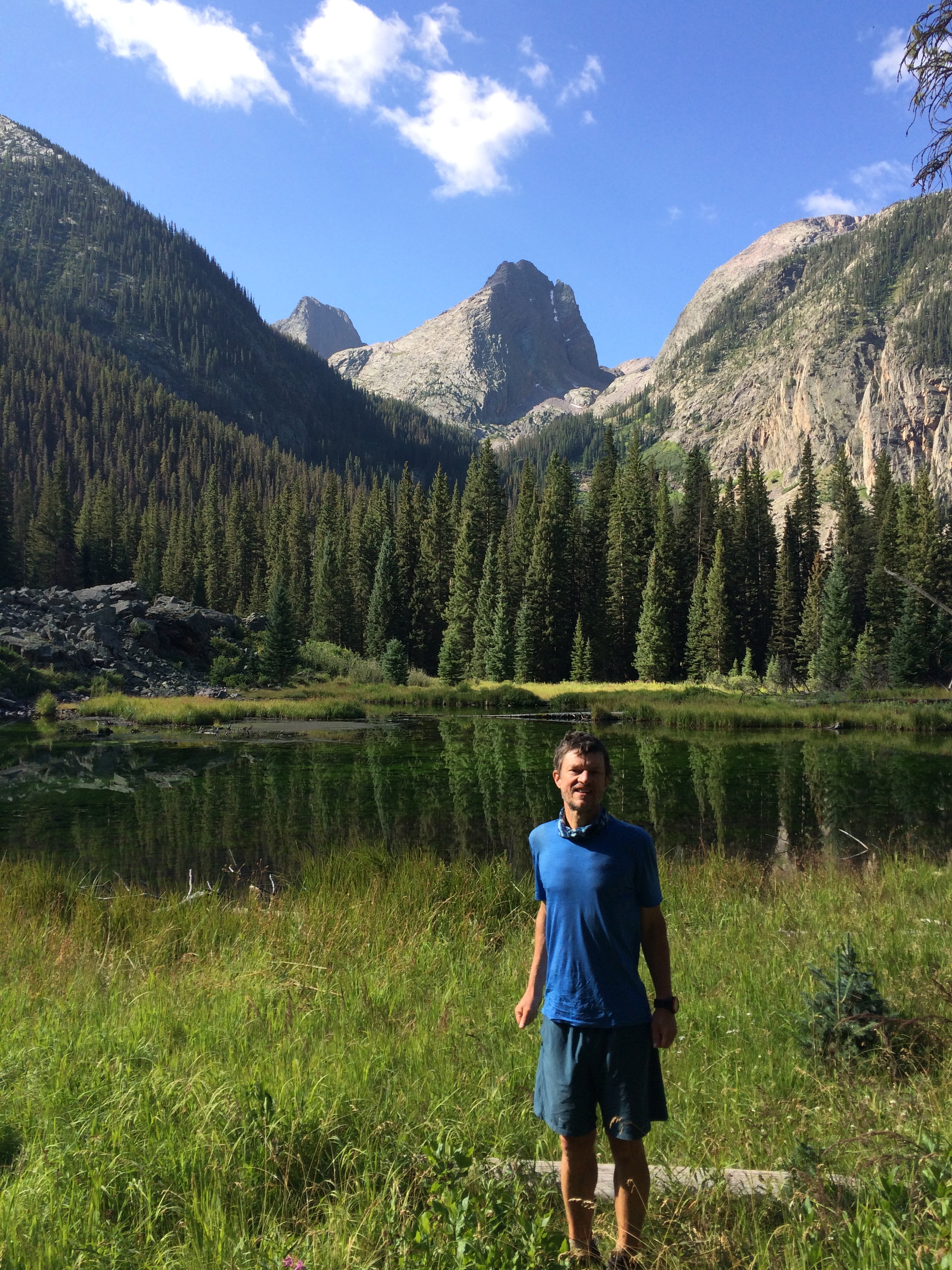
As we head up a hill, I see a dog staring down at us from above. I’ve read that there are vicious sheep-guarding canines on this section, so I’m wary. When we crest the hill I see the flock of sheep off to the left, but we keep our eyes lowered and the dog leaves us alone. We cross paths with a guy who is taking pictures of hikers on the trail; he takes our picture, and we take his.

We’re up above timberline now, and will be for the rest of the day. The hiking doesn’t feel terribly steep or hard, and I’m pleasantly surprised when we reach the CT high point at 13,271′. There are three young mountain bikers lounging up here; they tell us they’re going to Durango too and then take off and we have this place to ourselves.

We head down to Carson Saddle, passing the bikers, who have stopped on a grassy spot, and then they zoom past us again as we hike down a section of dirt road to the saddle. Even though it’s still pretty early, only about 3:00, we’re planning to camp a little bit further on, before the trail goes above timberline again. The guidebook doesn’t mention much in the way of camping, so I’m slightly worried the bikers will beat us to any available sites. When we cross paths again at the saddle, I employ some diversion tactics gleaned from my years of observing the male psyche.
You guys are probably going to camp up at Cataract lake, four miles on up the trail, right? It’s supposed to be gorgeous. But I don’t think we can make it that far.
I hope they take the bait. We round the bend and descend gently into the creek valley. The guidebook says there’s a campsite 50 feet below the trail about 1.2 miles in, where the trail crosses a small stream. The bikers have stopped there (again!) to get water.
We don’t see anything resembling a campsite, but after another mile or so there’s an absolutely perfect, established spot right next to the trail. It even has a flat rock that can serve as a table, and a fire ring! No mention of this in the guidebook, which we find very strange.There’s even a tiny stream nearby. We quickly pitch the tent.
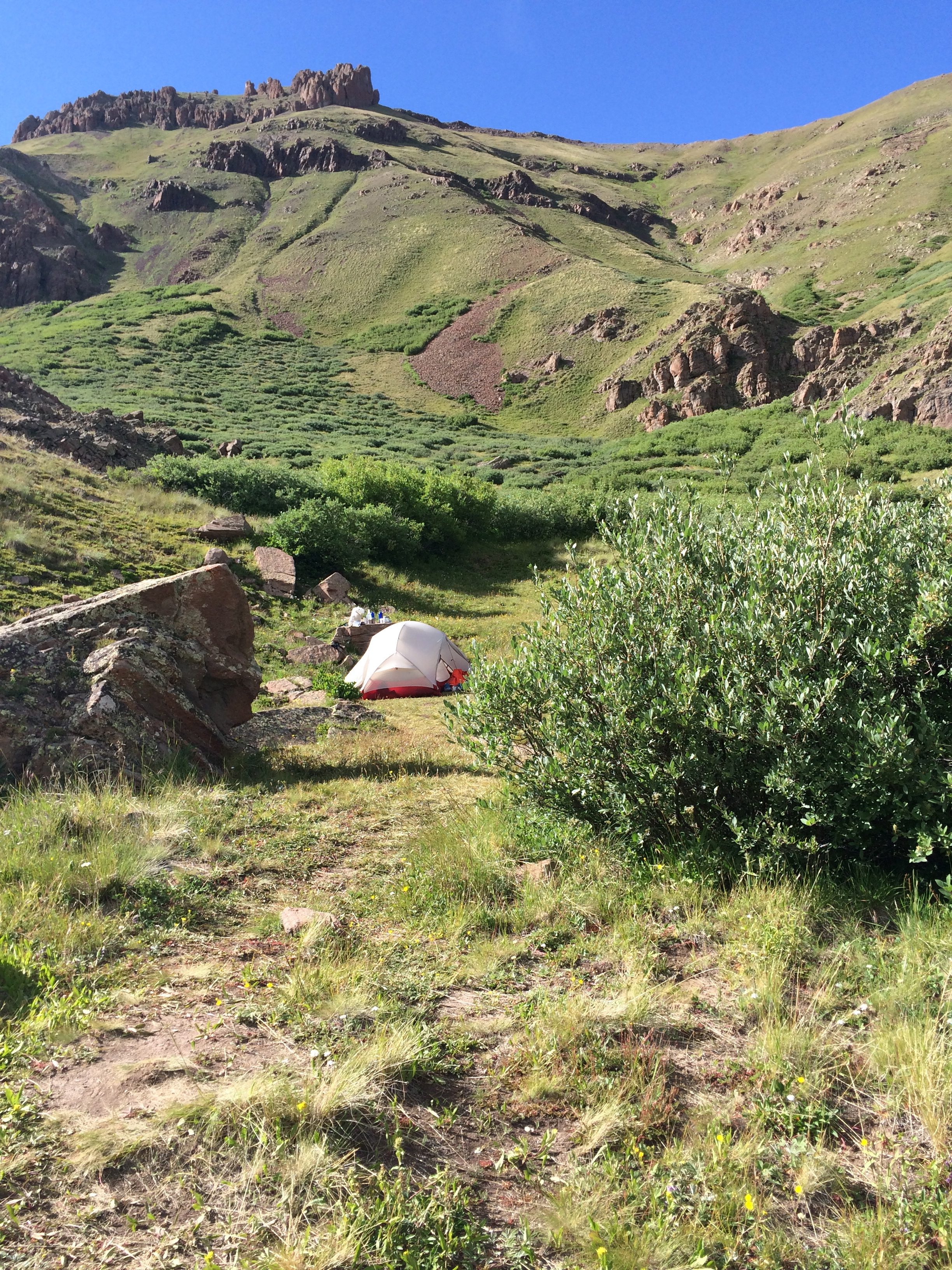
The perfect campsite
There’s an orange tent just above us that turns out to belong to Tortuga, the hiker who’d been camping at Pine Creek the night before our marathon across the sagebrush land. He didn’t stop in Lake City, and now he’s planning to try and hitch a ride into Silverton on the dirt road down from Stony Pass. It’s fun to see a familiar face.
The bikers go by, one of them pushing his bike, looking exhausted. I’m starting to wonder about these kids. The grade is not that steep here, and they’ve got a lot worse coming in the miles ahead. They don’t seem very experienced. Their gearing is clearly not appropriate. My mothering instincts kick in, but I quickly push them back down again. They’re young! They’ll be fine!
Marc’s pretty tired and he retires to the tent to read. It’s sunny and warm here, and I wander around as the sun lowers in the sky, trying to spot the moose that everyone says frequent the creek valley below, but I don’t see anything. I wish we had binoculars sometimes, but they’re too heavy. Every ounce counts…
During the night a fierce storm descends upon our little tent— lightning, thunder, heavy rain and what sounds like a rock slide on the other side of the valley. We listen to it rage outside and snuggle deeper down into our sleeping bags.
August 12
Miles hiked: 22.5
Total trip miles: 415.1
We get an early start today: it’s going to be a long haul, 18 straight miles up in the tundra until we head down into the Elk Creek canyon at the end of the day. Luckily, it’s all sunny, blue skies. On the way up to the pass before Cataract Lake, we pass Tortuga. And at the pass, who do we see but the biker guys, packing up their tents! It must have been an exciting night camping up here, what with all the lightning.
Cataract lake is indeed beautiful, but would have been a cold place to camp, windy and exposed. Our sleeping bags are barely warm enough even with our down jackets on inside them. A few extra degrees makes a big difference.
Today our energy levels are reversed. Marc’s full of pep and I’m dragging. It’s stunning up here, truly breathtaking. And I do mean that literally. At 12,000′ + there’s not a whole lot of oxygen, and this trail just keeps going up and down, up and down, over one big pass after another.
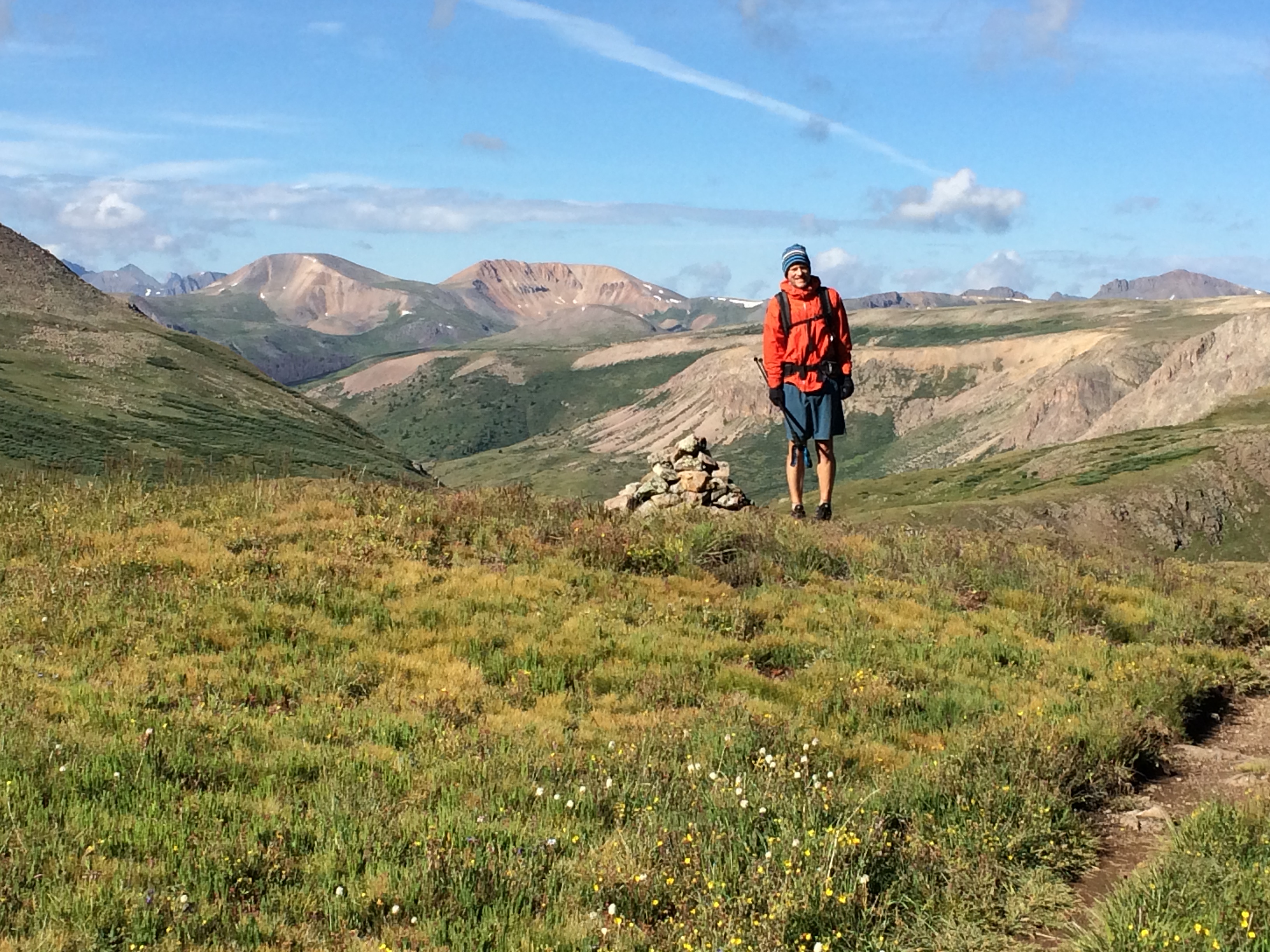
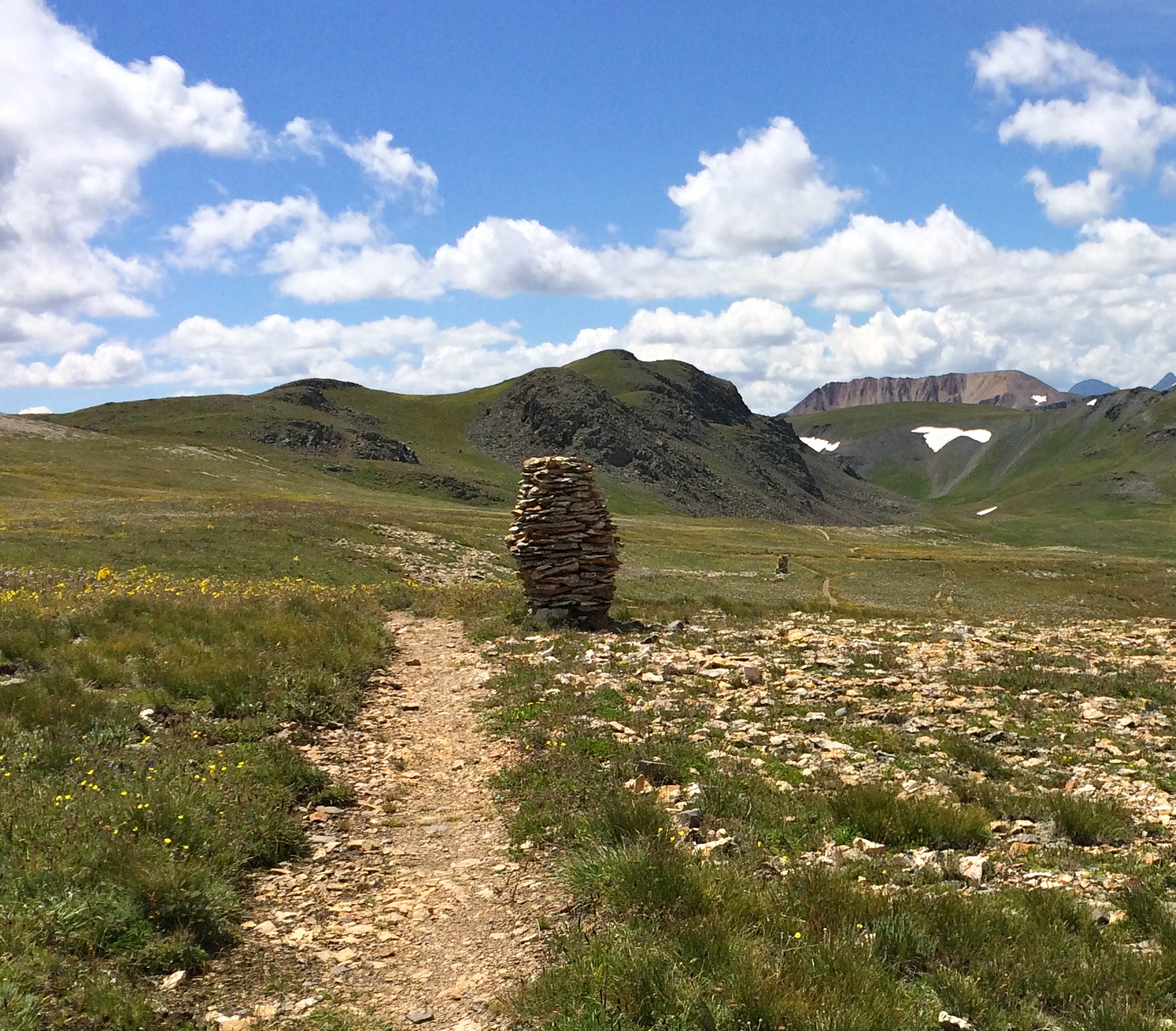 We’re lucky, because the weather continues to be perfect. No storms in our vicinity, and not much wind, either. The trail is often marked by a series of magnificently constructed cairns like this one. There were spots where the soil and rocks were a striking blue-gray color; I have a passing twinge that I should be more interested in the geology of this landscape than I am.
In this picture, you can see the color behind Marc:
In fact, this is one thing I’ve noticed about our hike: the deeper we get into it, the less we look at the landscape from an objective, intellectual point of view, and the more we just connect with it on a much more basic level. It’s not Take a look at that fascinating subduction zone! But instead, Oh, what amazing glittery shiny stones! What a steep hill! Look at those elk tracks!
The official CT guidebook is quite heavy on geology; this is probably of searing interest to about 10% of the people using it. Every night when we read the trail description for the day ahead of us, I find myself skipping over these extensive geological analyses with a bit of irritation. It’s the same feeling I sometimes get in an art museum, where the analysis of what it all means or the detailed life history of the artist is printed up and put on the walls. If I don’t watch out, that intellectualizing gets in the way of just having an authentic response to the art itself. This is true for the trail, too: in some ways, it’s almost better not to know what’s in store, because then you just hike it with a fresh mind, take things as they come, and notice how it feels and what you find interesting along the way. If you’re focusing on analyzing the geology, or identifying all the plant species underfoot, or tracking the exact elevation gain and loss you’re doing, you don’t get as much of a big experience, one in which you allow yourself to just feel what it is to be alive up here on top of the world.
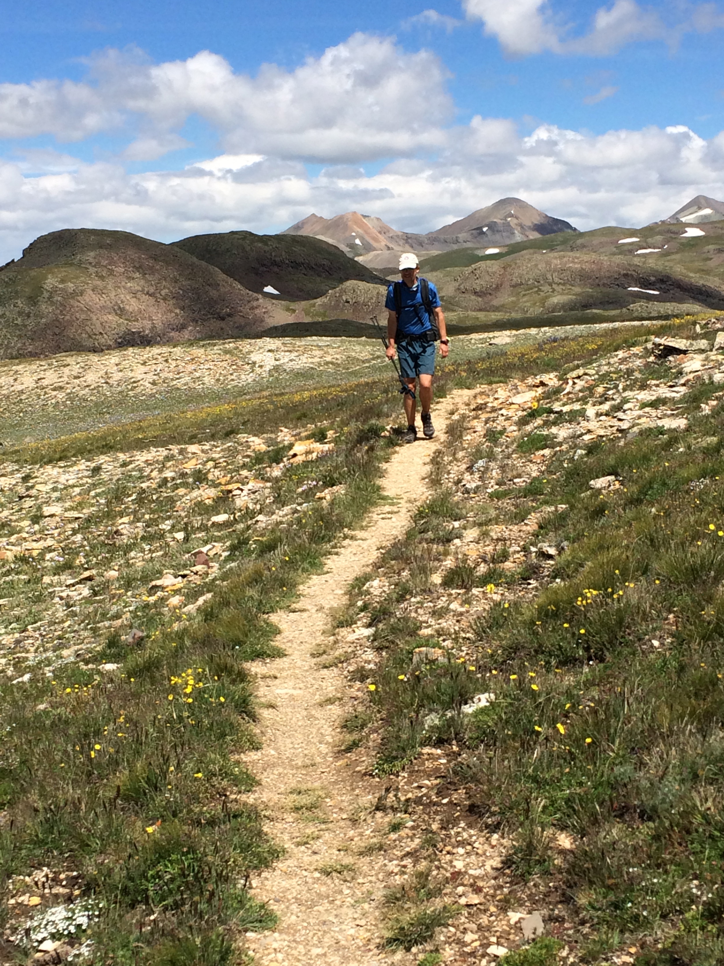
Enough philosophizing. Suffice it to say there were cool gray-blue rocks. As we hike, the iconic ridge in the background of that first photo gets closer and closer, and then we pass it and leave it behind us. Just before we cross Stony Pass and enter the Weminuche WIlderness, we come across a big group of people eating lunch together. One of them is a British guy who is “yo-yoing” or doing the hike in both directions. Whoa! That’s something. Here’s Rawah Ranger’s interview with him.
I had thought at one point that it might be okay to camp up here at high altitude, next to some lakes. But it’s becoming increasingly obvious that this is not a good idea —it’s just way too exposed and cold up here to camp. We see tons of elk footprints. Where have they all gone? We can see practically forever up here, but I don’t see any large grazing herds of elk. The flowers are beautiful, the skies a patchwork of puffy clouds. I mean, look at that picture!

Finally, after what seems to me like forever, we part ways with the Continental Divide Trail and then head down about a zillion paintbrush-covered switchbacks into Elk Creek Canyon. I have rarely seen such a display of color; in my tired state I just soak it in and don’t even think to take a picture. There’s an old miner’s cabin here where one of the people we’d passed camped last night, but we decide to carry on a little lower.

Parting of ways with the CDT
There are a few campsites right on the trail, but we wait until I see what I’ve been looking for — a faint trail leading off in the direction of Elk Creek. We follow it and find a campsite right along the creek. It’s buggy, but we’ve got Deet. Chemicals be damned, it works. The mosquitoes buzz around, confused, without landing. I set up the tent and Marc gets going on our aperitifs and tea.
This was a long, long day, full of beauty, full of ups and downs, a test of our legs and lungs and mettle.
Tomorrow we hike into Silverton, where we’ll meet up with Rob and then tackle the last leg of our adventure. Because we’ve hiked so many miles today, tomorrow will be easy. Or so we think…
August 13
Miles hiked: 11.2
Total trip mileage: 426.3
In the morning we continue on down Elk Creek, noticing that there are lots of great places to camp along the way. In some of them there are people just getting up and stretching. We pass a pond filled with green algae — Drew, the father from Durango, had told us about this place. In the background are the two iconc peaks, Vestal and Arrow, part of the Grenadiers range.
Further on, we hear a strange sound echoing up from below, and I finally realize it’s the steam locomotive of the Durango to Silverton Narrow Gauge railway, a tourist attraction. It toots its horn several times as it chugs on by. There’s a stop just off the trail where hikers can get on and off. Clouds of black smoke trail in its wake as it carries on down the valley. I wonder what the animals must make of all this commotion. I find it a bit unsettling.
We cross the tracks down by the Animas River. It’s running a brilliant orange color — Rick’s wife had warned us that a mine spill upstream had released toxic levels of lead, cadmium and arsenic. Even if I hadn’t known about it ahead of time, there’s no way I’d collect drinking water from this.
After the Animas, the trail heads uphill again, switchbacking up and up to Molas Pass. We can see cars on the highway long before our trail spits us out at the top, and it seems like a much longer hike than the 11 miles we actually clock.
Once at the pass, we need a ride into Silverton, 7 miles away. We plant ourselves at the side of the road and stick out our thumbs. No one stops. Is it our hats? I instruct Marc to take off his hat and sunglasses, and I do likewise. The cars keep going by. There’s a parking area here, and we try to make eye contact with drivers turning onto the highway. Some of them shrug and mouth the words “no room” — others just avoid our eyes entirely.
I decide we need to have our packs on our backs, so it will look like we need less room in the vehicle. I don’t think we look all that scruffy, and I’m surprised it’s taking us so long to get a ride. Finally, a white Ford SUV pulls up and a guy gets out and opens the back up for us. Phew! The sky was starting to look pretty gray, and a few drops had started to fall.
The driver is middle-aged guy who lives in Durango and is on his way to visit his elderly mom. There are golf clubs in the back of the SUV. Marc taps into the fairly large portion of his brain that’s devoted to sports trivia and comes up with names, tournaments, and other details that keep the two of them busy talking until we pull up at the Prospector Motel in downtown Silverton. If I ever criticized Marc for his obsession with sports, I take it all back now. It was great to be able to just sit back and relax!
At the Prospector we’re greeted by Andy, a big, jovial guy who’s full of jokes and sarcastic wit. He’s also a trove of useful information on Silverton. Our room is right behind the office, and aside from a slight problem with the doorjamb, which is getting repaired, we’re invited to collect our resupply box and go ahead and settle in. While Marc showers, I take the tent out to air in the parking lot (the usual condensation) — and who should roll up on his bike but Rob! Great excitement!
We shop for meals for him at the outfitter, get some fresh food at the market, scout the laundromat at the RV park (no go — there’s a waiting list stretching to 9 pm!) and get some cash from the bank. Silverton’s not quite as “cute” as Lake City; it seems a little grittier and rougher around the edges. The lack of a good laundromat is a big drawback in my book. Here’s a sign I saw on one store window:
 WIld west, indeed!
We hit a local restaurant for some food and, more importantly, beer, and exchange stories of our respective adventures up to this point. Rob’s biked for the last couple of days, through epic amounts of mud. We’re hoping the CT is an improvement. We peruse maps for the rest of the trail and decide we don’t need five days to do it, four will be enough, and call mom and Sandy to let them know when we anticipate our exit.
It isn’t until after we hang up with Mom that we realize we’ll be finishing this trail on August 17, the 6th anniversary of Dad’s death. How fitting that we will all come together on that day, here in the mountains that he loved so much.
Then we head back to the room to hang our hand-washed laundry, sort through the resupply, and pack ourselves up for the last leg of this epic adventure. Andy is taking us up to the pass early in the morning. It’s not a free shuttle, but all I ask is that you pay me what you feel it’s worth to you, he says. I love his cheerful, helpful, welcoming attitude. It’s characteristic of what I’ve encountered everywhere along this trail. People are basically kind and helpful, interested and interesting.
Bravo, bravo – and walking into a town with the pack apparently growing out of your shoulders felt so cool, so happy, even if your feet were screaming for mercy….
susan