
July 26
Miles hiked: 17.4
Total trip mileage: 121.8
The only coffee shop open in Breckenridge at 6:30 doesn’t serve lattes, so I console myself with a donut. I’ve forsaken coffee on this trip because I like a lot of milk in my coffee and the powdered variety just isn’t right. Tea bags are much lighter, anyway.
We take the shuttle back up to the trailhead and start climbing right away. Up, up, up. I’m feeling great! I power on up on donut-fueled legs. We slog 3,600 feet up, topping out at 12,500′. We pass a couple of college boys having lunch at the pass, but the clouds are looking a bit iffy and we still have a few miles to go above treeline before our descent into the Copper Mountain ski resort, so we keep going.
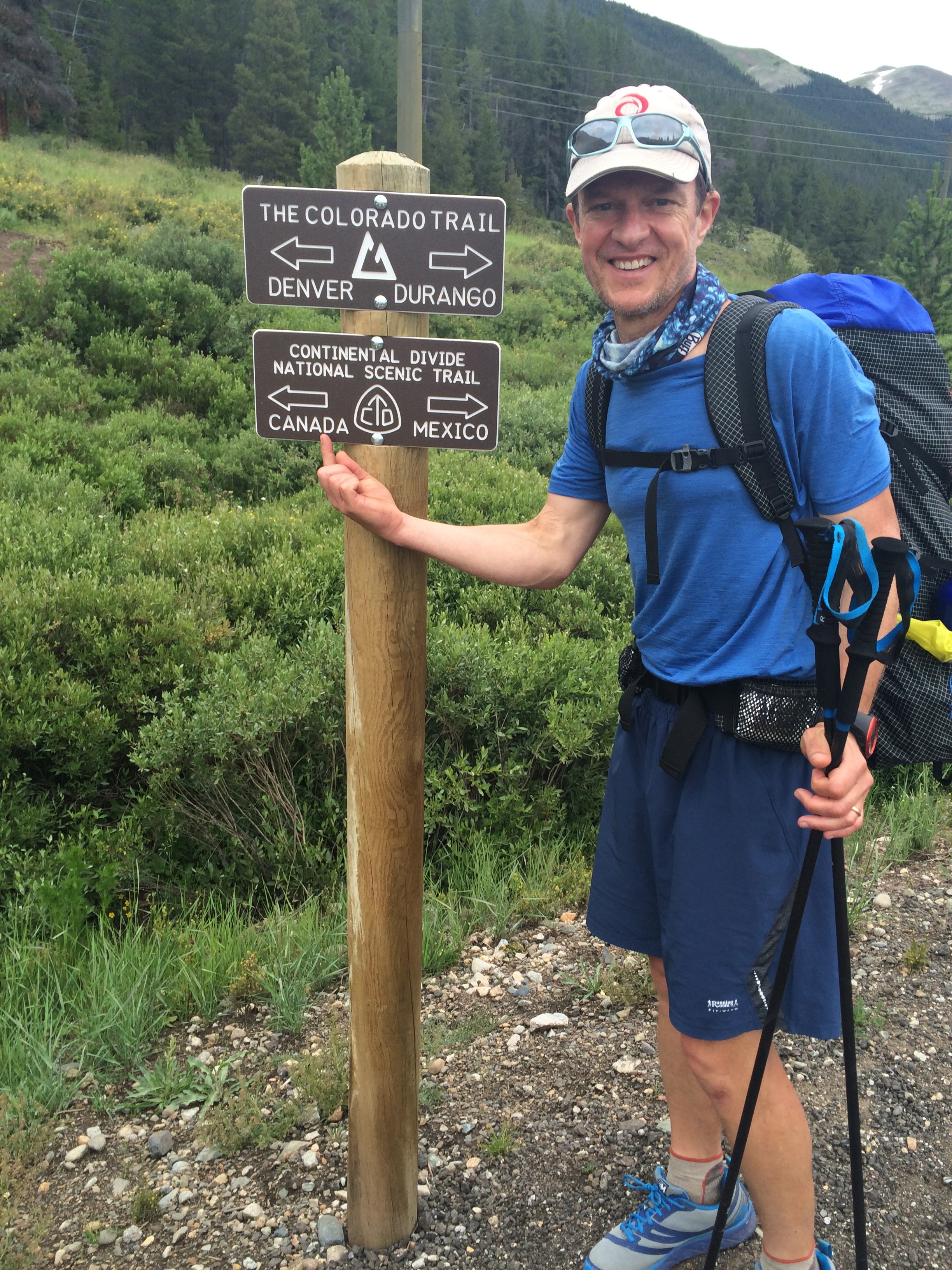
I love it up here! Alpine tundra is my favorite hiking place. The trail is good. We don’t see any other people here, we feel like we have the mountains to ourselves. There’s a monster storm visible way off in the distance to the southwest. Just before the trail plummets back into the trees we stop for a break. The college kids zoom on by. At the bottom of the hill we join up with the Continental Divide trail. Canada is on the sign!
Copper Mountain is kind of strange. There’s a golf course and lots of condos, but the place seems totally dead compared to Breckenridge. It looks like it’s stuck somewhere in the 1980s. We have no desire to go and check it out. We keep hiking on the road that skirts the base of the ski hill. Some deer grazing on the slopes stare at us as we walk by.
The trail finally leaves Copper Mountain property, where you’re not allowed to camp, and we reach Guller and Jaque creeks where the Guidebook says there’s “a campsite”. Unfortunately it’s occupied by a posse of lounging teenagers.
Up above their site is another tent, tree branches propped up on its walls. We go further uphill, determined to find a spot, and encounter a strange lean-to structure in the trees. Finally we go back down below the trail and set up our tent on a flattish spot between the two creeks.
We introduce ourselves to the teenagers; turns out it’s two college kids in charge of a group of high-schoolers. They think it’s totally awesome that we’re out here celebrating our 25th anniversary.
A little while later one of the them comes down to our camp. A woman has emerged from the tent above them and run down through their campsite, yelling at them about the trees. The counselor is freaked out. I tell her the woman’s probably harmless — I had heard about her on a trail forum — but if it would make them more comfortable, they’re welcome to move their camp nearer us. We find a relatively flat spot nearby and they schlep all their stuff down the hill.
Not too long after this a bow hunter and his son bushwhack by us, asking about the woman. Apparently she yelled at them, too. We tell the story, and he says he’s going to call the forest service. You not supposed to stay longer than 14 days in a campsite.
I never lay eyes on her, myself. Just as well.
July 27
Miles hiked: 24.6
Total trip mileage: 146.4
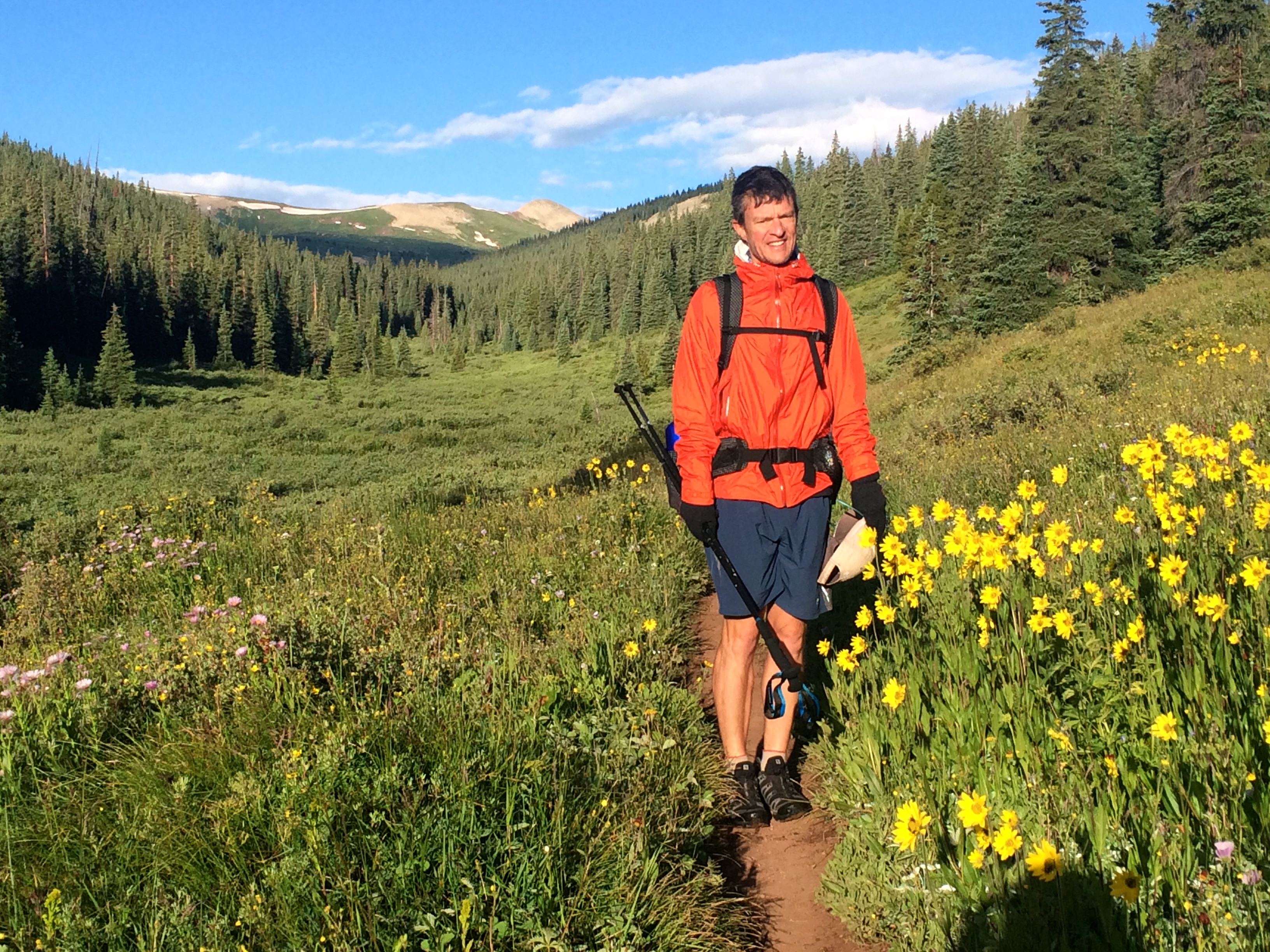
As we peek out of the tent this morning it looks like a perfect day. Aside from that rainy day before Breckenridge, we really haven’t had any bad weather. Hiking up this valley is like being in paradise. Great trail, stunning flowers, mountains in the distance. This is about as good as it gets! There are plenty of places we could have camped along the trail, and I’m a little irritated at the guidebook because it gave me the impression that the one at Guller creek was the only option.
We stop just before tree line to eat our breakfast, and the two college boys zoom by, heading up to Searle pass. They’d spent the night in a hut just below the trail here. That would have been great! Next time.
After the pass there is a long, gentle downhill section all up in the tundra. I keep stopping to take pictures and Marc, whose fingers still aren’t completely warm, gets way ahead of me. I know he’s worried about exposure up here, getting hit by lightning. The clouds are piling up, but they’re not really menacing yet.

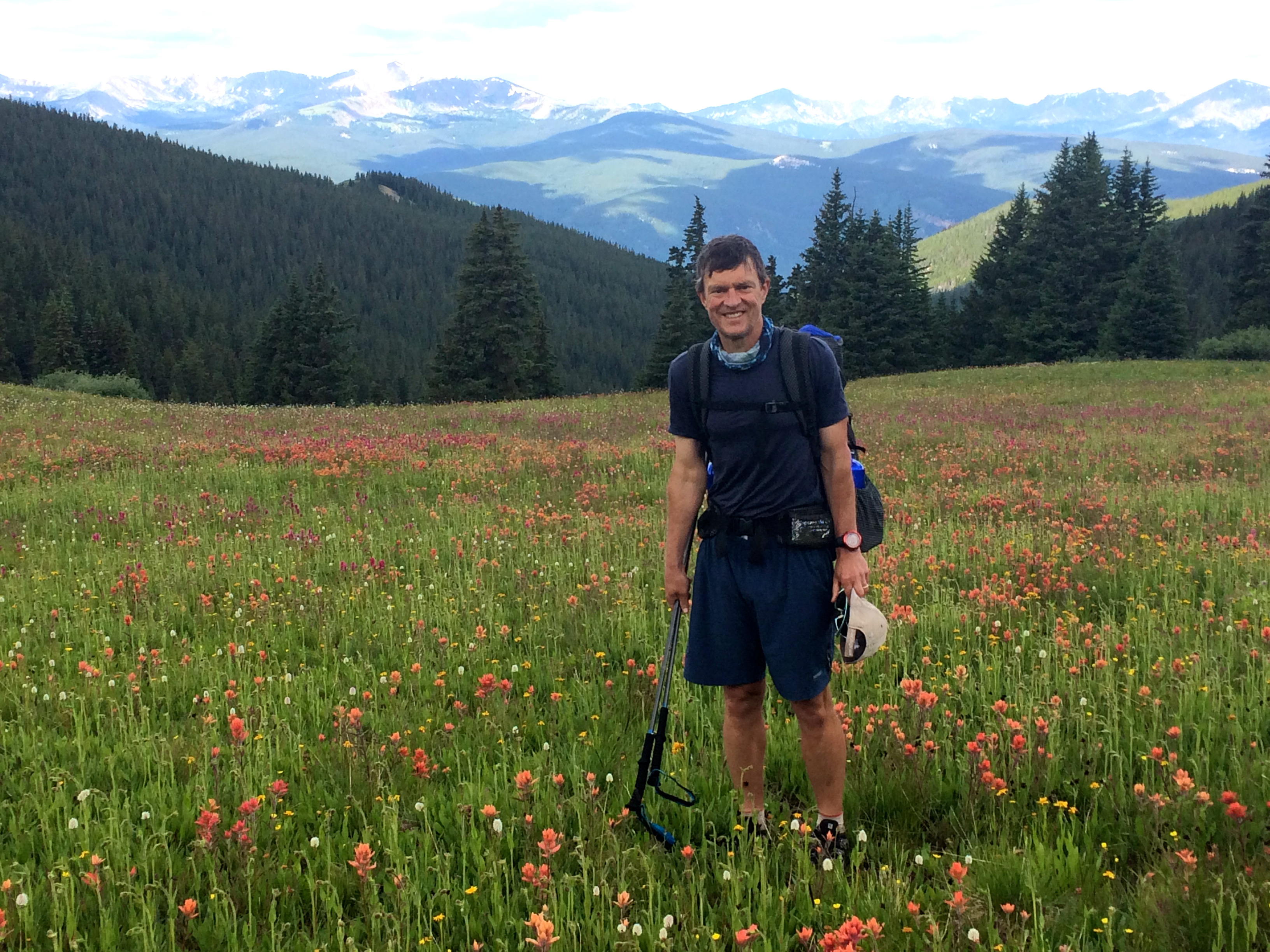
We reach pass #2 for the day, Kokomo pass, and I pose for a picture before we plunge down on a paintbrush and daisy-covered hillside. I’ve never seen wildflowers like this before!
The trail descends about 3,000 feet to Camp Hale, an old army place, flat and hot. Along the way a couple of day-hikers and a large group of mountain bikers pass us going up. I pity them the climb.
Our plan is to stop at a long grassy meadow alongside Mitchell Creek, where the guidebook says there are “potential campsites.” We cross the creek and head up the meadow. I’m lagging today, and Marc gets out of sight ahead of me. I’m closely following our position on the trail app, looking for campsites. But the place where the trail is closest to the creek comes and goes and Marc hasn’t stopped. I haven’t seen anything that could be considered a camp site, the bushes are too dense. We’re now heading uphill, away from the meadow and the water. I don’t know if Marc’s ahead of me or behind. I feel totally alone out here. Finally I catch up to him at a road junction where he has stopped to talk to a man and his son who are day hiking.
The guy tells us that there’s no water on this section of the trail, but we can just hike few miles after Tennessee Pass to a creek. It’s no big deal. I show him our trail app, trying to see where he’s talking about, and he scoffs at it condescendingly. I’m upset at Marc for hiking on ahead so fast without trying to find a campsite like we’d planned, tired after already hiking 18 miles, and daunted at the thought of hiking 6 more miles. I don’t like this guy and his attitude. Maybe because of that we decide to carry on. Show him who’s a wimp!
It’s actually pretty easy hiking on this smooth road. My back isn’t as bad as it was before Breckenridge. We just go on and on and on, talking a bit since we can hike side by side. The trail is well marked, but water there is none. All the streambeds intersecting the trail are dry. And this is a “wet” year! Will the creek be running? Will we die of thirst?
And then we come upon a cooler next to the trail, stocked with Pabst Blue Ribbon, juice, and sodas. I drink two cans of juice and Marc downs a couple PBRs. We add our names to the notebook in the ziplock next to the cooler, dump our empties in the trash bag provided, and silently thank the trail angels responsible for this fortuitous offering.
Not more than a mile later, Marc hears a crashing sound and stops up short. It’s a moose! he whispers, backing up in alarm. Sure enough, there’s a massive bull moose blocking the trail. munching on some willows in a dry streambed. We talk in loud voices for a minute, hoping it will move off, but it just looks at us. A detour is in order. We bushwhack down below the trail and back up the other side. When we look back, we see two moose! The bushes are too thick to get a decent picture, though.

Soon enough we hit Tennessee creek. It’s flowing! There are a few barren campsites here in the trees. I know there’s another creek in 0.2 miles, and there we find a great site, a bit off the trail, mountains as a backdrop with the gurgling water right at our doorstep. It’s mosquito heaven but we plaster ourselves with deet and enjoy our dinner. There’s something about having a good campsite that is just so satisfying.
We’ve hiked almost 25 miles! I can’t believe it. I feel so strong and amazing! We’re glad we kept going – if we hadn’t we wouldn’t have seen those moose. Maybe that jerk was a trail angel in disguise. What a day! Marc cooks dinner as the sun heads down.

July 28
Miles hiked: 19.1
Total trip miles: 165.5
It was a cold night. It’s nice to camp by water, but creeks are usually in valleys, and cold air pools there at night. We wake up to frost on the ground. We’re both wearing our puffy down jackets in our sleeping bags and barely staying warm enough. We see a guy hiking by as we eat breakfast. I wash the breakfast dishes to save Marc’s fingers from freezing, and we pack up and follow.
We catch up to the hiker, who is only going as far as Turquoise Lake reservoir, and he turns out to be quite chatty. I don’t have my hearing aids on the trip so I’m not a good trail conversationalist. I need to see faces when I talk. He and Marc chat and I hike on my own ahead of them. I like hiking without talking.
In fact, that’s one of the things I’m liking the best about this hike. Marc and I both go along, in sight of one another, a comfortable presence to each other but not intruding on one another’s psychic space. Sometimes we feel like talking and we talk, but mostly I like to just move without thinking about much, just taking it all in, intoning mantras if it’s uphill or I’m tired. I brought some audiobooks and music on my phone, but I have zero desire to tune into them.
HIking like this is very zen. I’m in the moment, and it’s an incredibly rich experience —the trail, the sky, the texture of the trees, the color of the rocks, the sounds of birdsong and squirrel chatter. If I think about anything, it’s whether or not that cloud up there will rain on us and how much farther we should go before taking a break.
Even though we read the guidebook in the tent at night, we never really know what to expect when we start out each day. The weather will be what it is —we’ll be hiking no matter what. The trail might be smooth sailing or a minefield of ankle-twisting rocks and roots. There might not be a good place to camp for 20 miles. Whatever the trail dishes out to you, you have to just roll with it. I think this is why thru-hiking is so different than regular backpacking. We never know for sure in the morning where we’ll be sleeping that night. The rhythm is so different. You settle in, putting aside all the rest of your life and your worries, and just focus on the basics: water, the weather, your body, the ground beneath your feet.
We pass a big group of Boy Scouts, and they re-pass us. They’re headed for the Mount Massive trailhead, still a long ways off. It seems like they’re suffering, and we doubt they’ll make it that far today. We also pass the college boys again. They’re also planning to hike Mount Massive, a “fourteener”, tomorrow.
We leave our chatterbox at the turnoff to Turquoise Lake around 1:00 and start to climb again. We’re psyched to encounter our first mountain bike racer. Bikes have to detour the wilderness area we just left, so we have no idea how close to the head of the pack he is. But we cheer him on anyway.
We’re planning to camp on a ridge, where the guidebook says there is an “exposed, dry campsite”. Marc has calculated how much water we need to cook dinner and then breakfast. We fill up at a creek a half mile from the ridge (“potential campsites” the guidebook says are here are not evident at all to us) and climb up to it, but we don’t see anything. I know it must be here, so I take off my pack and scout around – sure enough, I find a site hidden behind some rocks.
Tomorrow we’ll get to Twin Lakes, where a box will hopefully be waiting for us at the store. We’re meeting up with Rick, a good friend from Boulder. We’re taking a day “off” to hike up Mount Elbert with him.
July 29
Miles hiked: 9.8
Total trip miles: 175.3
In the morning, we pass the college boys in hammocks and the group of Boy Scouts still asleep in their tents. They must have passed us in the evening. They’re camped in a nice spot at a creek next to the Mount Massive trail intersection. This great campsite isn’t mentioned in the guidebook, which we find irritating. Why does it mention all those nonexistent “potential campsites” and then fail to point out this one? Never mind. There wouldn’t have been room for us anyway.
We don’t have far to go today, and it’s beautiful hiking on a smooth, wide trail. We cross paths with more bike racers, who stop to talk with us about the race. The turnoff to Twin Lakes Village is well marked and we head down down down into the town.
It’s not so much a town as it is a spot on the road with some “historic” buildings. The General Store doesn’t have much in the way of fresh food, but Marc buys what he can find and we sit on a bench in front of the “museum” eating peaches and waiting for the Inn to open at 3 pm.
When we check in, I notice a flyer for a massage therapist who comes to the hotel. I call and book a half hour session. Shoulder medicine! We retrieve our box from the store and Rick arrives. He gives us a care package full of useful stuff from his wife. So nice! While I’m having my back attended to, Marc and Rick scout out the trailhead for the first portion of the Collegiate West route. The official trail goes all the way around the lake, practically back to this point. No way are we doing 7 extra miles of flat, hot boring road walking if we can avoid it. Imagine a big capital letter C. The trail up Hope pass starts near the upper jaw of the C. Twin Lakes is near the lower jaw. Makes more sense just to hop across the gap than slog all the way around, am I right?
We eat a gourmet dinner at the Inn with Rick and catch up on all he’s been up to. Marc and RIck did research together in the summer at NCAR for many years, and they’re both nuts about running. They can go on forever about science and running and sports in general, but we finally turn in. Sleeping in a bed is heavenly.
July 30
Miles hiked: 12.1
Total trip miles: 187.4
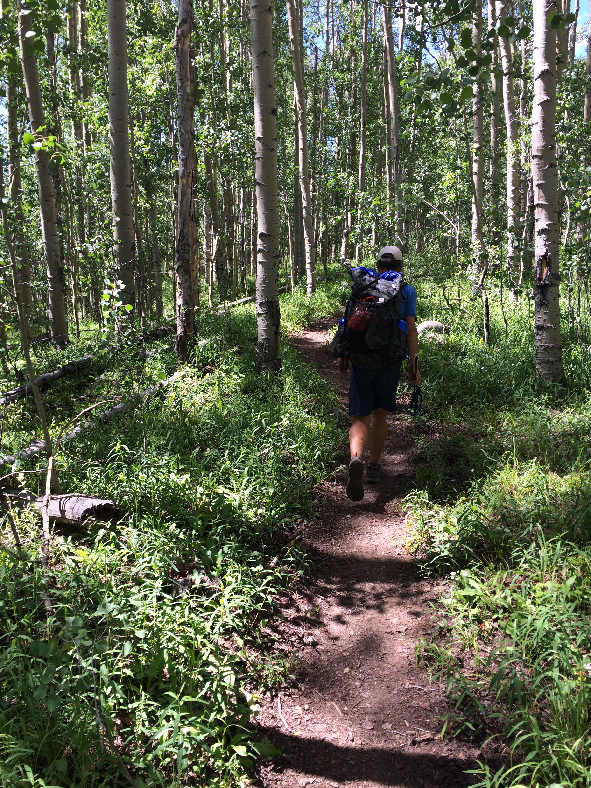
We drive up to the South Mount Elbert trailhead at 7:30. Marc is carrying water and some snacks in his pack —I’m carrying nothing! I feel light, like a grasshopper! It’s a beautiful day, and we set a steady pace up to the upper trailhead, retracing some of our steps from yesterday through some ancient-looking aspen groves.
Aspen trees mostly reproduce by sending up shoots from their roots, so what looks like separate individuals are actuallly just one big organism. I find this astonishing. The Forest Service describes the largest known clone, in southern Utah: it’s over 100 acres in size, weighs more than 14 million pounds, and is an estimated 80,000 years old. Holy cow. These trees we’re walking through are part of a massive organism that could be tens of thousands of years old!
Mount Elbert is the highest point in Colorado. We have to climb 4,850′ to reach the summit. When we do, there’s a crowd there. Groups of people have also come from another trail to the north. They take pictures of themselves holding pictures saying “Mount Elbert, 14,433 feet.”
A guy tells us we’re incredibly lucky— these are the calmest and clearest conditions he can remember. Of course I didn’t bring my phone so I didn’t get a picture. Believe me when I say you can see pretty much forever. Is that New York City over there?
On the way down we encounter a guy in a batman t-shirt who we had passed on the way up. He’s from Florida and he’s hurting from the altitude. I tell him that’s normal, this is Colorado’s highest mountain. It is? I didn’t know that! How could you be climbing this mountain and not know that, I wonder? He perks up. That makes me feel so much better!
Back in Twin Lakes we eat another gourmet dinner with Rick — I could get used to this! — pack up our stuff, catch up on e-mail. We’re starting tomorrow again at 7:00, Rick, our own personal trail angel, is going to drive us to the trailhead.
UPDATE: Rick did have his camera, and has sent us this photo of the three of us on top of Mount Elbert! Thanks Rick!
